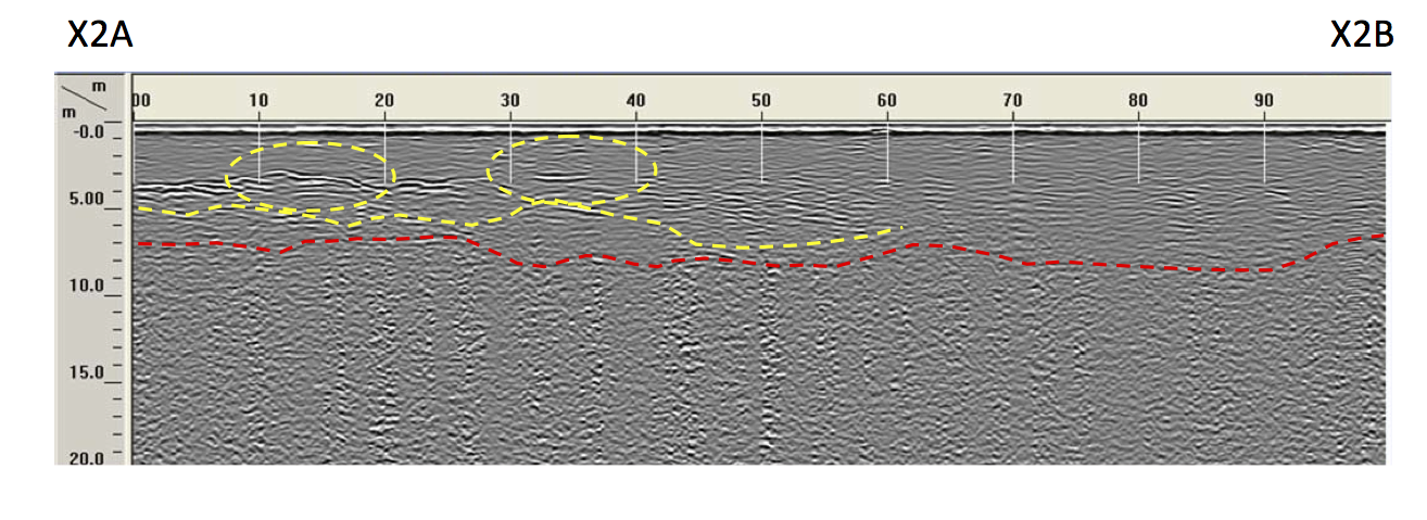
About a month ago, JP and Cody drove up to Hubbard Brook to spend their spring break running a ground-penetrating radar (GPR) survey in Watershed 3 to estimate depth to bedrock and glacial till thickness. Both JP and Cody’s projects are part of our Hydropedology project, which is focused on explaining the spatial and temporal variation in stream water chemistry at the headwater catchment scale using a framework based on the combined study of hydrology and soil development. We initially used GPR in August 2007 in an attempt resolve depth to densipan, near-stream lag deposits, and hillslope “pinch points” where Bh podzols may develop. We were reasonable successful with that survey, but had only surveyed one 30 m transect. Over spring break JP and Cody worked with Steve Arcone from the Army Corps of Engineers Cold Regions Research and Engineering Lab in Hanover, NH and surveyed over 2 km of transects in Watershed 3! Steve is a GPR expert and our goal was to sense depth to bedrock to help us understand soil development, geochemistry, and hydrology in the catchment. An image from that survey is shown above. The radar suggests depth to bedrock along that transect is about 4 to 8 meters. Reflection horizons were consistently evident at that depth for many of the transects, but we will need to verify the GPR profiles with some boreholes this summer. If in fact the depth to bedrock is that deep, it is much deeper than we thought for the Hubbard Brook catchment and it might implications for water storage, weathering, etc.. Stay tuned for more information.
In other news on our Hydropedology project, we just hired a Research Experience for Undergraduates (REU) student that will work with us this summer as part of the Hubbard Brook LTER. We are excited that Bridget O’Neill from University of Pittsburgh will join us in June.